
Back-to-back storms to hit Southern California
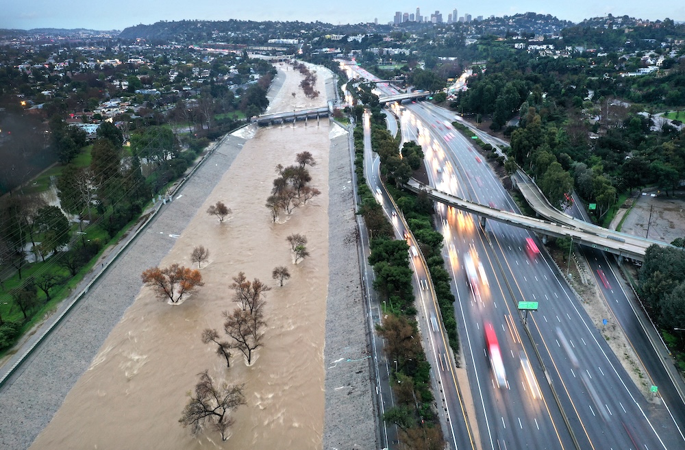
An aerial view of the Los Angeles River swollen by storm runoff as a powerful long-duration atmospheric river storm hit Southern California on February 5, 2024. Mario Tama/Getty Images/AFP
LOS ANGELES – Just when the region was drying out from recent record-setting rains, another storm system is set to move through the area early next week, although it’s still uncertain how much precipitation might fall in the Los Angeles area.
According to the National Weather Service, conditions are expected to remain dry for the next few days, with temperatures even potentially slipping above normal on Friday. But things will start cooling down slightly on Saturday, when the leading edge of the storm system will begin to impact the Central Coast by late Saturday.
Little rain is anticipated in the Southland Saturday, and if any does fall, it would likely be less than one-tenth of an inch.
The brunt of the storm front is expected to arrive Sunday night and continue through Wednesday, with “the potential for multiple rounds of heavy showers and perhaps a few thunderstorms to affect the region,” forecasters said.
The total amount of rain expected to fall remained uncertain as of Thursday afternoon. In the more heavily impacted Central Coast, as much as 5 inches was being anticipated in lower elevations, and up to 8 inches in mountains and foothills, but Los Angeles-area totals were expected to be lower depending on the track of the storm system.
Initial predictions call for a total of between 2 and 3 inches in many portions of the Southland between Sunday night and Wednesday, but forecasters said “it still may be a few days from now before greater confidence can be ascertained.” according to the NWS.
The NWS noted that while the next system won’t rival the record-breaking rains that fell earlier this month, the fact that the area is already saturated could make some areas more prone to flooding.
“The bottom-line message is that everyone is encouraged to closely monitor the latest information from the National Weather Service, as there exists potential for major hydrological impacts Sunday night through Wednesday,” forecasters said.
“The recent extreme rainfall totals favor more hydrological impact from smaller subsequent precipitation amounts.” (CNS)
