
Evacuation warnings remain in storm-battered areas in SoCal
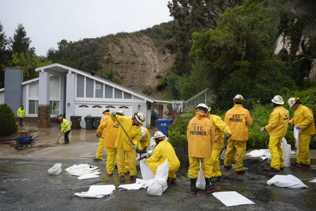
California Department of Corrections prisoners help sandbag homes along Gotera Drive in the Hacienda Heights section of Los Angeles on Tuesday, Feb. 6, 2024. (AP Photo/Marcio Jose Sanchez)
LOS ANGELES – Evacuation warnings remained in place today for many areas across the Southland as rain continued to raise the risk of mudslides and debris flows.
Residents in the La Tuna Canyon Road area north of Hollywood Burbank Airport remain under an evacuation order. The affected area is roughly bordered by Horse Haven Street to the north, Martindale Avenue to the east, Penrose Street to the south, and Ledge Avenue to the west, according to the Los Angeles Fire Department.
Eastbound La Tuna Canyon Road was closed to all but residents at Sunland Boulevard, while westbound was closed to all but residents at Honolulu Avenue. La Tuna Canyon Road was fully closed eastbound at Ledge Avenue and Westbound at the Foothill (210) Freeway.
An evacuation center for residents was opened at Sunland Senior Citizen Center at 8640 Fenwick St. Large animals can be evacuated to Hansen Dam Horse Park at 11127 Orcas Ave. in Lake View Terrace, and the LA Equestrian Center at 480 Riverside Drive in Burbank.
Evacuation orders that had been issued for the Agua Fire burn area along Soledad Canyon Road east of Agua Dulce Canyon Road and the Owen Fire burn area, on Santa Maria Road north of Topanga Canyon in the Topanga area, were both reduced Tuesday afternoon to evacuation warnings, although residents were still urged to be prepared to leave if needed.
The warnings were expected to remain in place until at least 6 p.m. Tuesday.
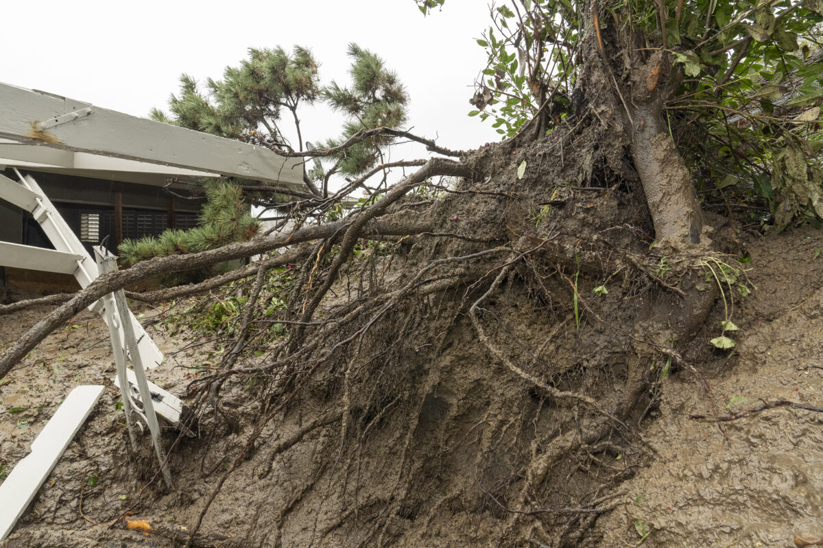
Roots of trees are revealed as mudflow forced its way down a hill into a home early Monday morning in the Baldwin Hills area of Los Angeles, on Tuesday, Feb. 6, 2024. One of the wettest storms in Southern California history unleashed more than 300 mudslides in the Los Angeles area after dumping more than half of the city’s seasonal rainfall in just two days, and officials warned Tuesday that the threat hadn’t passed yet. (AP Photo/Damian Dovarganes)
Additionally, evacuation warnings were issued for areas of unincorporated Los Angeles County near burn scars through 6 p.m. Tuesday, including the Juniper Hills and Valyermo areas from the Bobcat Fire, and the following areas of Lake Hughes and King Canyon from the Lake Fire:
- 20000 block of Pine Canyon Road;
- 18000 block of Ellstree Drive;
- 46000 block of Kings Canyon Road;
- 18000 block of Newvale Drive; and
- 43000 block of Lake Hughes Road.
Duarte also issued an evacuation warning for an area near the Fish Fire burn scar. That warning was originally set to expire at 10 a.m. Tuesday, but it was extended until 3 p.m. Tuesday.
Culver City on Monday issued evacuation warnings for various streets in the Upper Crest area due to concerns about possible mud or debris flows. City officials said the warnings will be in effect until 11:59 p.m. Tuesday.
Affected areas are:
- Cranks Road (Tellefson Road to St. James Drive) (10600 and 10700
blocks); - Tellefson Road (Cranks Road to Stubbs Lane) (5712 – 5825);
- Ranch Road (Tellefson Road to Cranks Road) (10600 and 10700 blocks);
- Stubbs Lane (entirety) (10700 block);
- Lugo Way (entirety) (10700 block);
- Youngworth Road (Ranch Road to Flaxton Street) (10600 block);
- Flaxton Street (Youngworth Road to Drakewood Avenue) (10600 block);
- Drakewood Avenue (Ranch Road to Northgate Street) (10600 block); and
- Bernardo Road (Tellefson Road to terminus) (10800 block).
An emergency shelter was established at the Veterans Memorial Complex Multipurpose Room, 4117 Overland Ave.
In Orange County, a voluntary evacuation warning remains in effect for Silverado, Williams, Modjeska and Trabuco canyons due to heavy rains. A map with detailed depictions of the areas under evacuation warnings can be found here.
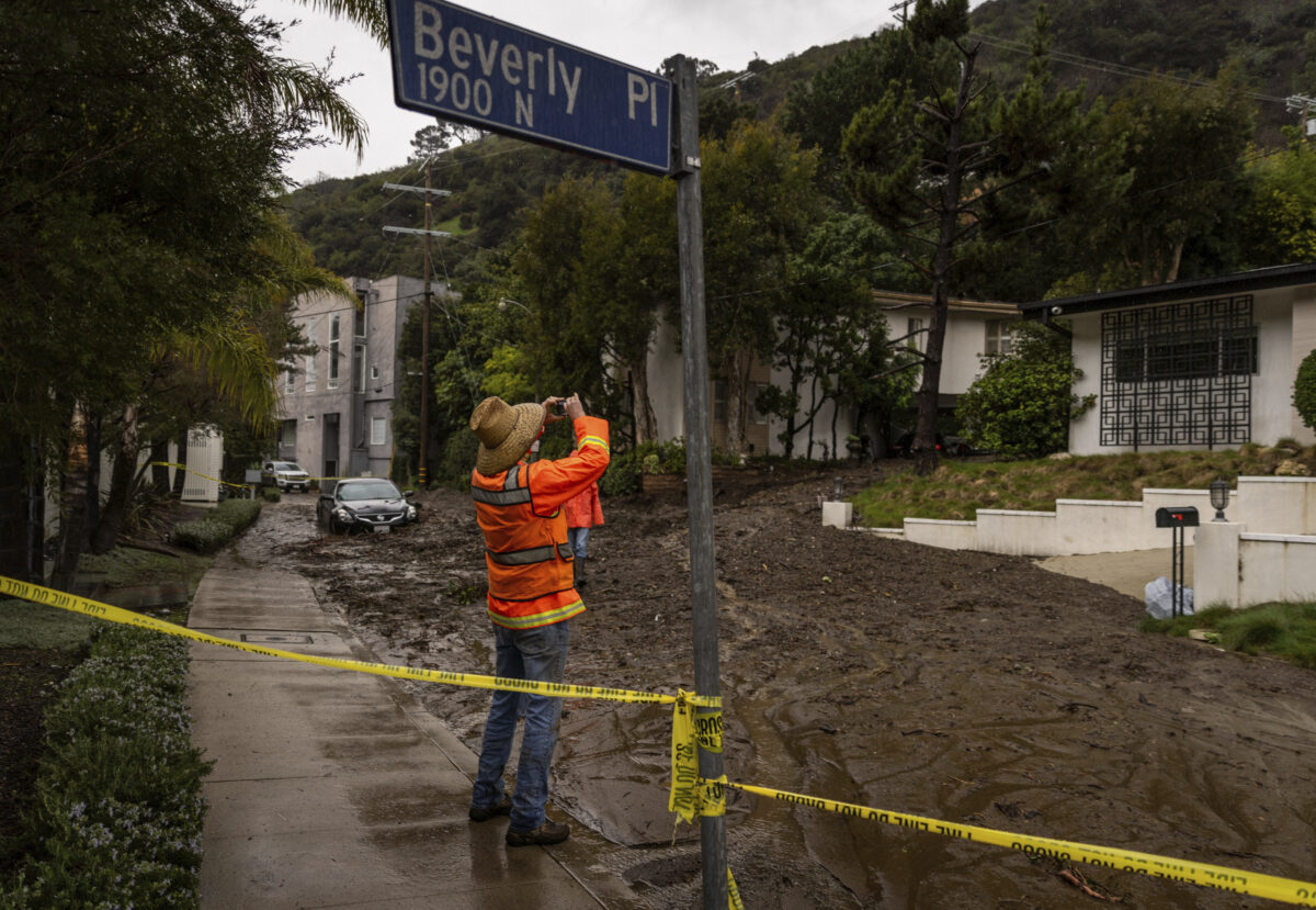
A geologist takes a picture while surveying a mudslide Tuesday, Feb. 6, 2024, in the Beverly Crest area of Los Angeles. (AP Photo/Ethan Swope)
Canyon residents were encouraged to prepare and voluntarily evacuate, especially those with disabilities, access and/or functional needs, and canyon residents with large animals.
Any residents with disabilities and those with access and/or functional needs requiring evacuation assistance were asked to call Orange County Sheriff’s Department Dispatch at 714-647-7000.
Orange County Animal Care encouraged animal owners in voluntary evacuation areas to implement their personal evacuation plans. Pet evacuation tips are available at ocpetinfo.com/education-resources/disaster-preparedness. Any person needing assistance with information about animal or large animal evacuations should call Orange County Animal Care at 714-935-6848 from 8 a.m. to 5 p.m. or 714-259-1122 after-hours from 5 p.m. to 8 a.m. (CNS)
