How Santa Ana winds fueled the deadly wildfires in Southern California

Jon Keeley, University of California, Los Angeles
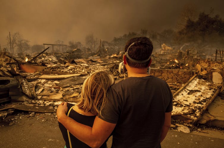
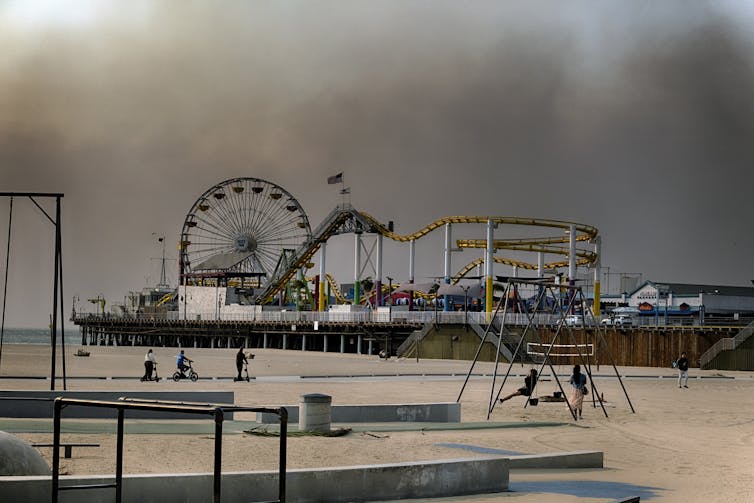
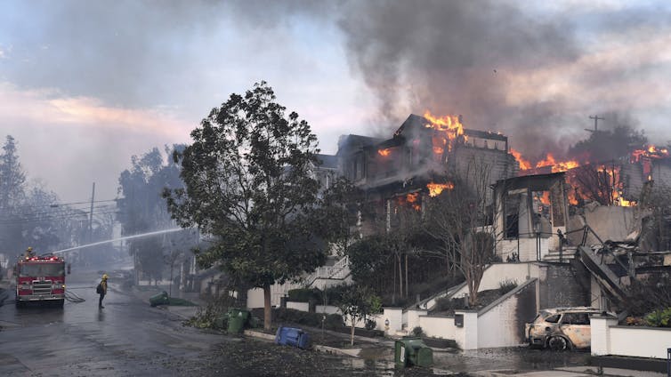
Powerful Santa Ana winds, with gusts reaching hurricane strength, swept down the mountains outside Los Angeles and spread wildfires into several neighborhoods in early January 2025, creating a terrifying scene.
Thousands of homes and other structures, including several schools, had burned by Jan. 12, and at least 24 people had died. The fires, which started Jan. 7, were still burning days later. Officials had urged more than 180,000 residents to evacuate. When the winds were strongest, there was little firefighters could do to control the flames.
Jon Keeley, a research ecologist in California with the U.S. Geological Survey and adjunct professor at UCLA, explains what causes extreme winds like this in Southern California, and why they create such a dangerous fire risk.
What causes the Santa Ana winds?
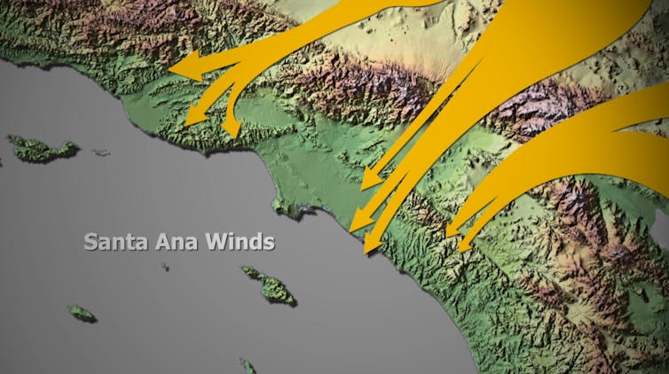
The Santa Ana winds are dry, powerful winds that blow down the mountains toward the Southern California coast. The region sees about 10 Santa Ana wind events a year on average, typically occurring from fall into January.
When conditions are dry, as they are right now, these winds can become a severe fire hazard.

The Santa Ana winds occur when there is high pressure to the east, in the Great Basin, and a low-pressure system off the coast. Air masses move from high pressure to low pressure, and the more extreme the difference in the pressure, the faster the winds blow.
Topography also plays a role. As the winds rush downslope from the top of the San Gabriel Mountains, they become drier and hotter. That’s a function of the physics of air masses. By the time the winds get to the point where the Eaton Fire broke out in Altadena on Jan. 7, it’s not uncommon for them to have less than 5% relative humidity, meaning essentially no moisture at all.
Canyons also channel the winds. I used to live in the Altadena area, and we would get days during Santa Ana wind events when the wind wasn’t present at all where we lived, but, a few blocks away, the wind was extremely strong.
These strong, dry winds are often around 30 to 40 mph. But they can be stronger. The wind gusts in early January 2025 were reported to have exceeded 80 mph.
Why was the fire risk so high this time?
Typically, Southern California has enough rain by now that the vegetation is moist and doesn’t readily burn. A study a few years ago showed that autumn moisture reduces the risk of Santa Ana wind-driven fires.
This year, however, Southern California has very dry conditions, with very little moisture over the past several months. With these extreme winds, we have the perfect storm for severe fires.

It’s very hard to extinguish a fire under these conditions. The firefighters in the area will tell you, if there’s a Santa Ana wind-driven fire, they will evacuate people ahead of the fire front and control the edges – but when the wind is blowing like this, there’s very little chance of stopping it until the wind subsides.
Other states have seen similar fires driven by strong downslope winds. During the Chimney Tops 2 Fire in Tennessee in November 2016, strong downslope winds spread the flames into homes in Gatlinburg, killing 14 people and burning more than 2,500 homes. Boulder County, Colorado, lost about 1,000 homes when powerful winds coming down the mountains there spread the Marshall Fire in December 2021.
Have the Santa Ana winds changed over time?
Santa Ana wind events aren’t new, but we’re seeing them more often this time of year.
My colleagues and I recently published a paper comparing 71 years of Santa Ana wind events, starting in 1948. We found about the same amount of overall Santa Ana wind activity, but the timing is shifting from fewer events in September and more in December and January. Due to well-documented trends in climate change, it is tempting to ascribe this to global warming, but as yet there is no substantial evidence of this.
California is seeing more destructive fires than we saw in the past. That’s driven not just by changes in the climate and the winds, but also by population growth.
More people now live in and at the edges of wildland areas, and the power grid has expanded with them. That creates more opportunities for fires to start. In extreme weather, power lines face a higher risk of falling or being hit by tree branches and sparking a fire. The area burnt because of fires related to power lines has greatly expanded; today it is the major ignition source for destructive fires in Southern California.

The Eaton Fire, which has burned many homes, is at the upper perimeter of the San Gabriel Basin, at the base of the San Gabriel Mountains. Fifty years ago, fewer people lived there. Back then, some parts of the basin were surrounded by citrus orchards, and fires in the mountains would burn out in the orchards before reaching homes.
Today, there is no buffer between homes and the wildland. The point of ignition for the Eaton Fire appears to have been near or within one of those neighborhoods.
Homes are made of dried materials, and when the atmosphere is dry, they combust readily, allowing fires to spread quickly through neighborhoods and creating a great risk of destructive fires.
This article, originally published Jan. 8, has been updated with new details on the fires.
Jon Keeley, Research Ecologist, USGS; Adjunct Professor, University of California, Los Angeles
This article is republished from The Conversation under a Creative Commons license.

