‘Life-threatening’ windstorm batters Southern California

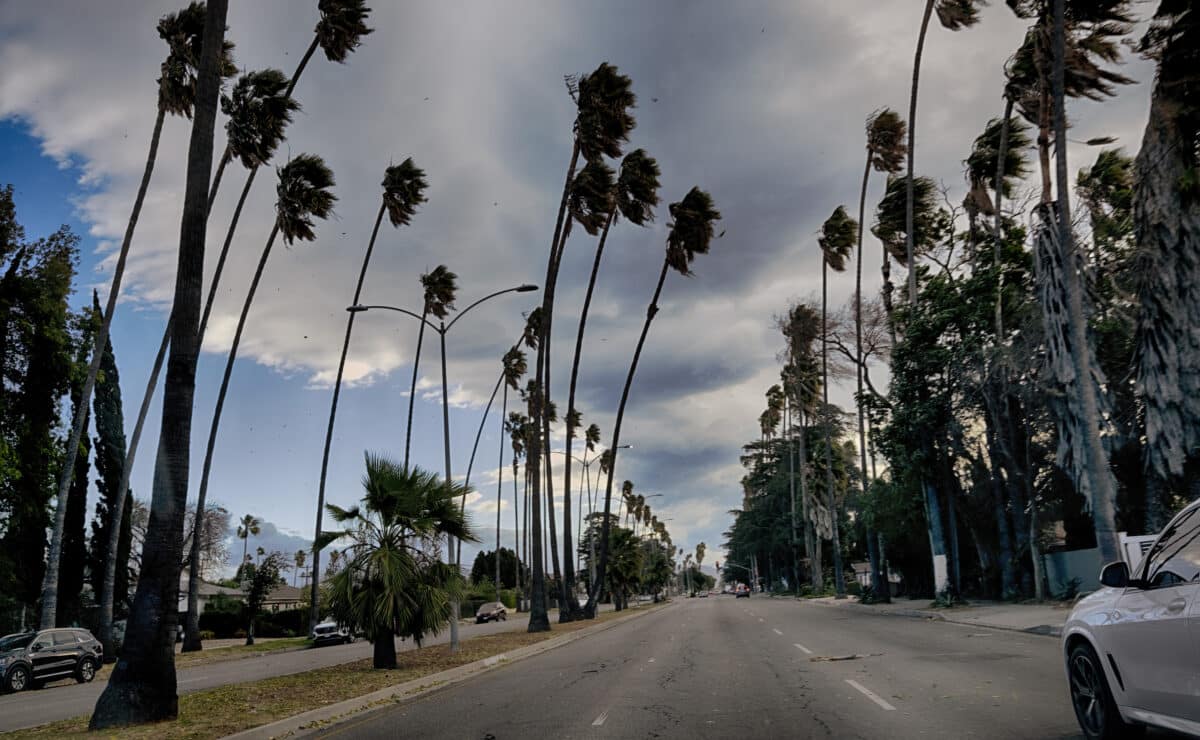
Tall palm trees sway during extreme gusty winds in the Van Nuys section of Los Angeles, on Tuesday, Jan. 7, 2025. (AP Photo/Richard Vogel)
LOS ANGELES – Potentially life-threatening Santa Ana winds blasted the Southland Tuesday, dramatically raising the risk of wildfires, fanning a rapidly moving brush fire in Pacific Palisades and even forcing President Joe Biden to cancel a planned trip between Los Angeles and Riverside counties.
National Weather Service forecasters said the windstorm was likely to be the worst to hit the region since 2011, with the gusty conditions expected to continue through at least Thursday.
“Winds will peak this evening through Wednesday morning,” according to the NWS. “Downed trees, hazardous driving conditions, increased traffic, power outages, and airport delays are to be expected across Los Angeles and Ventura counties. Any wildfires that start may spread rapidly with extreme fire behavior.”
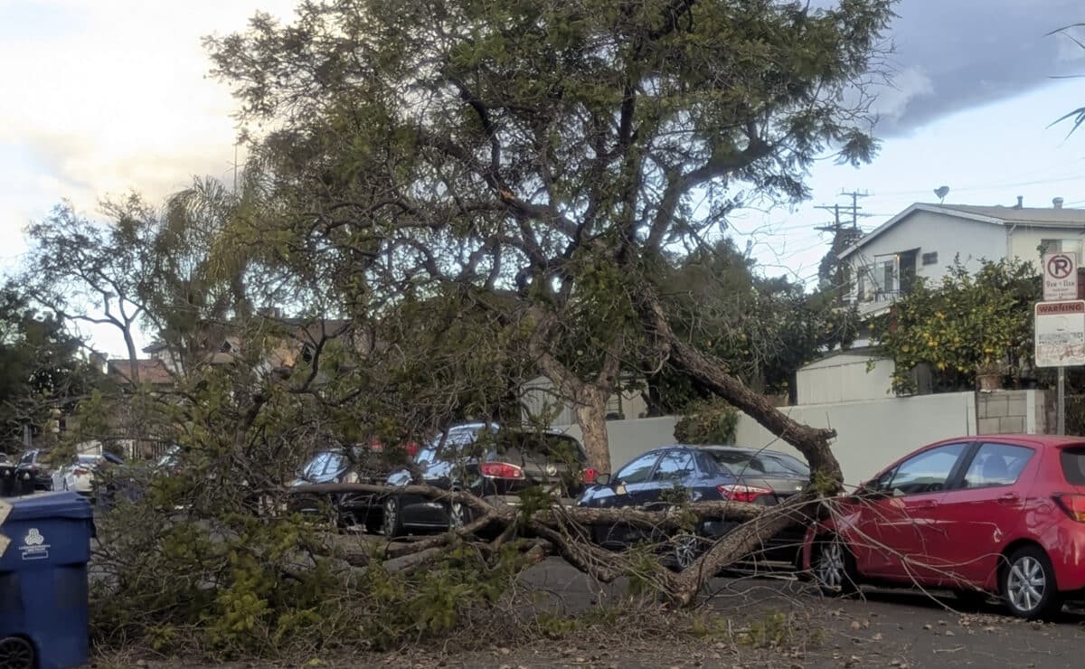
The winds began battering much of the region early Tuesday morning. In Burbank, high winds topped trees, forcing a closure of Glenoaks Boulevard between Olive and Orange Grove avenues, according to the city. Harvard Road at Sunset Canyon Road was closed going up the hillside due to tree failure.

A tree blocks a street after falling amid strengthening winds Tuesday, Jan. 7, 2025, in Northeast Los Angeles. (AP Photo/Christopher Weber)
The dangerous winds prompted closure of the Los Angeles Zoo to the public on Tuesday. Zoo officials said they would assess whether to reopen Wednesday. The Santa Monica-Malibu Unified School District announced it was closing all Malibu schools Tuesday due to dangerous weather conditions but that Santa Monica schools remained open. Several Los Angeles Unified School District campuses in the area also relocated classes due to the fire danger.
Brush fire
In Pacific Palisades, a brush fire erupted late Tuesday morning and rapidly spread across more than 200 acres in less than an hour, burning homes and forcing evacuations of thousands of residents.
“Residents across Southern California are urged to remain vigilant and monitor the latest forecasts,” the National Weather Service advised.
“There is high confidence in strong offshore winds with the potential to be the strongest wind event of the season, especially for the Southland valleys. Trees, large tree branches, and power lines may be downed by the wind …Residents living the near the foothills and mountains are advised to review the `Ready, Set, Go!’ fire plan. Most residents should be in the `Set’ stage and being prepared to go in the event of the fire evacuation.”
Red flag warnings of critical fire danger took effect at 4 a.m. Tuesday and will remain in place until 6 p.m. Thursday for the Malibu coast, the Santa Monica Mountains Recreational Area, the San Gabriel Valley, the San Fernando Valley, Calabasas, the Santa Clarita Valley, the San Gabriel Mountains, and the Golden State (5) and Antelope Valley (14) freeway corridors.
At noon Tuesday, the warning extended to include Los Angeles County beaches, the Palos Verdes Hills, Catalina Island and the inland Los Angeles County coast, stretching into downtown Los Angeles.
Red flag warning
A separate red flag warning will be in place until 6 p.m. Wednesday in the Antelope Valley and Antelope Valley foothills.
The warnings were upgraded to “particularly dangerous situation” red flag warnings — noting extremely critical wildfire conditions — at noon Tuesday and continuing until 4 p.m. Wednesday for L.A. County beaches, the coastal area stretching into downtown, the Malibu Coast, the Santa Monica Mountains Recreational Area, the San Fernando Valley, San Gabriel Valley, San Gabriel Mountains and the Antelope Valley (14) Freeway corridor.
In Orange County, a red flag warning will be in place through 6 p.m. Thursday for the Santa Ana Mountains and inland parts of the county, including a “particularly dangerous situation” from 7 a.m. to 1 p.m. Wednesday. Orange County coastal areas will be under a red flag warning from 4 p.m. Tuesday to 6 p.m. Wednesday.
“A very strong, widespread, and destructive north to northeast windstorm will bring Extremely Critical fire weather conditions to many areas of Los Angeles and eastern Ventura counties Tuesday afternoon into early Wednesday afternoon,” according to the NWS. “This is a PARTICULARLY DANGEROUS SITUATION (PDS) Red Flag Warning event in many areas, with the combination of very strong upper level wind support, tightening offshore pressure gradients and moderate cold air advection.
“The strongest winds with this event are expected to be Tuesday afternoon into early Wednesday afternoon when widespread damaging wind gusts of 50 to 80 mph are likely,” forecasters said. “The San Gabriel mountains, Santa Susana mountains, and foothills of the San Gabriel/San Fernando Valleys will likely see areas of destructive wind gusts between 80 and 100 mph. … The strong winds will likely result in widespread downed trees/power lines, as well as widespread power outages.”
Most destructive windstorm since 2011
Forecasters said the event “will likely be the most destructive windstorm seen since 2011 windstorm that did extensive damage to Pasadena and nearby foothills of the San Gabriel Valley. Any communities along Highway 118 and 210 corridors will be at highest risk for comparable wind damage.”
Forecasters warned particularly of the possibility of “breaking mountain waves.”
“These occur when very strong winds aloft intercept mountain tops at nearly perpendicular angles which will happen with these events,” according to the NWS. “These short lived and very difficult to predict events can cause considerable local damage wherever they occur.
The most likely areas for this phenomena are the eastern San Fernando Valley and the northern San Gabriel Valley.”
Humidity levels are also expected to drop, most notably on Wednesday, creating dry conditions that could amplify the fire danger.
Due to the elevated fire danger, Caltrans closed Topanga Canyon Boulevard between Mulholland Drive and Pacific Coast Highway from 10 a.m.
Tuesday through 6 p.m. Friday. Only residents and local business traffic willbe permitted into the canyon during the closure.
Fire departments across the area pre-positioned resources so they could quickly respond if brush fires erupt. Officials with Cal Fire said the agency moved resources from Northern California to Southern California, including 45 engines and six hand crews that will be stationed in the region, including Los Angeles and Orange counties.
The peak of the wind event is forecasted from 10 p.m. Tuesday to 10 a.m. Wednesday, the Los Angeles County Fire Department warned in an alert.
“The LACoFD reminds residents living in wildfire-prone areas to take appropriate precautions: See something, say something. Report any sign of smoke or fire immediately to your local fire department by dialing 9-1-1. If you dial 9-1-1 from your cell phone, be sure to know your location.”
Power shutoffs and possible evacuations
County fire officials also urged residents to be prepared for power shutoffs and the possibility that they might have to evacuate their areas.
Cal Fire Chief Joe Tyler reminded residents that 95% of wildfires are human-caused, and he urged vigilance.
“As we experienced in Ventura County in November with the Mountain Fire and again in December with the Franklin Fire in Malibu, wildfire is a year-round threat,” Tyler said in a statement. “Please be vigilant and don’t be the cause of the next wildfire in your community.”
NWS officials warned residents to be prepared for the possibility of downed trees and power poles and hazardous driving conditions, particularly for big rigs and other high-profile vehicles.
The winds could also result in air travel delays and turbulence. Forecasters also advised residents to stay away from windows and trees once the winds start, park cars away from trees, and to prepare for possible power outages by charging all electronic devices ahead of time and ensure generators are prepared.
As is standard during high-fire-danger conditions. Southern California Edison customers in some areas could have their power turned off under the utility’s Public Safety Power Shutoffs program. The program is designed to de-energize power lines that could potentially be damaged and spark a wildfire during red flag conditions.
As of early Tuesday afternoon, more than 4,400 SCE customers in Los Angeles County had their power cut due to the program. Another 113,500 customers in the county were under consideration for power cuts, along with nearly 13,000 in Orange County.
Updated information about power cuts is available here.
The city of Los Angeles imposed red flag parking restrictions at 8 a.m. Tuesday, continuing until further notice, likely for the duration of the wind event. The restrictions are designed to keep streets clear for emergency vehicles that may need to quickly access developing wildfires, and to ensure open roadways for residents who may need to evacuate. Pasadena city officials implemented similar parking restrictions.
The South Coast Air Quality Management District, meanwhile, issued a windblown dust advisory that will be in effect until at least 6 p.m. Wednesday, noting that the strong winds could lead to unhealthy air quality in areas of Los Angeles, Orange and Riverside counties. (CNS)

