
Bridge Fire explodes, burns homes in Southern California
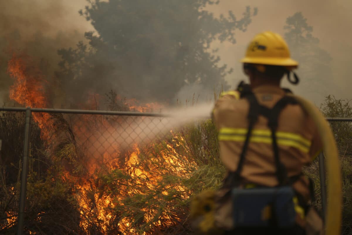
A firefighter douses flames in the perimeter of a property while battling the Bridge Fire Wednesday, Sept. 11, 2024, in Wrightwood, Calif. (AP Photo/Eric Thayer)
SAN GABRIEL CANYON – The Bridge Fire that erupted in the San Gabriel Canyon above Glendora grew to 51,167 acres Thursday as it chewed through terrain and structures in San Bernardino County, becoming the largest active blaze in California.
The wildfire was reported around 3 p.m. Sunday near the area of East Fork and Glendora Mountain roads, according to officials with the Angeles National Forest. On Tuesday afternoon, the fire was listed at about 4,100 acres, but by early evening, it had exploded in size to more than 34,000 acres.
As of Wednesday afternoon, Cal Fire reported that the blaze had burned 49,008 acres, fueled by thick brush that carried the flames into the San Bernardino County community of Wrightwood and the Mountain High Ski Resort. By 6:50 p.m., it had grown to about 50,250 acres with 0% containment.
And by 6 a.m. Thursday, it had grown to 51,167 acres, remaining at 0% containment.
“On the south end, the fire jumped Glendora Ridge Road up to Sunset Peak, which was highly visible at night from the inland cities below,” according to a Thursday morning statement from Cal Fire.
“Despite the extreme fire behavior, lack of resources, and challenges firefighters faced, they successfully defended homes, and no communication towers went down. Firefighters held the lines they had west of Mount Baldy Road and continued to prioritize securing contingency lines to the south. By the public heeding evacuations, firefighters could get in and engage in the structure defense they needed,” the Cal Fire statement said `
`Governor Gavin Newsom has announced a Fire Management Assistance Grant External Link from the Federal Emergency Management Agency to help ensure the availability of vital resources to Los Angeles and San Bernardino counties,” the Cal Fire statement said.
Los Angeles County Fire Department Chief Anthony Marrone said that as of Wednesday morning, the fire had destroyed about 20 homes in the Mount Baldy area, 13 homes in the Wrightwood area and six cabins in the wilderness areas affected by the blaze.
But Marrone said no significant injuries were reported and no deaths.
Marrone noted that despite slowly cooling temperatures, “we still have potential for large fire growth today.” “It’s very steep terrain, inaccessible, so that’s making it a challenge for our firefighters,” he said.
Los Angeles County Sheriff Robert Luna said an off-duty sheriff’s deputy and two people with him in the fire zone were trapped by the flames Wednesday morning near the Mount Baldy area. He said they were not injured, but rescue teams hoping to hoist them to safety were unable to immediately reach the trio due to the heavy smoke in the area, forcing them to simply wait for conditions to improve.
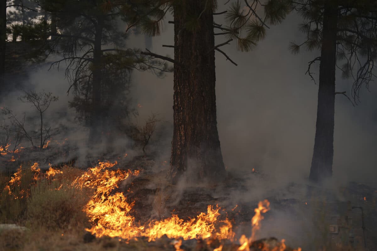
A forest burns from the Bridge Fire Wednesday, Sept. 11, 2024, Wrightwood, Calif. (AP Photo/Eric Thayer)
The three people were safely evacuated from the area about 1:30 p.m. Wednesday, and were treated for minor injuries, according to the Los Angeles County Sheriff’s Department.
Although the flames advanced on Mountain High Ski Resort, officials at the popular destination posted on social media Wednesday that “all the main lifts and buildings survived with little to no damage.”
The Los Angeles County Sheriff’s Department issued a mandatory evacuation order for the East Fork communities of Camp Williams and River Community on Sunday evening. On Monday, an evacuation order was issued for all residents north of San Antonio Dam up to the Mount Baldy Resort.
As of Thursday morning, evacuation orders were in effect for:
— Pinon Hills from Wrightwood north to Highway 18 and Beekley Road west to L.A. County; — Lone Pine Canyon from the community of Wrightwood to Highway 138/Lone Pine Canyon Road south to the forest; — Entire community of Wrightwood; — East Fork communities of Camp Williams Resort (café, mobile home park, campground) and River Community (near the resort); and — The area from Highway 138 south to Lone Pine Canyon and Highway 2 east to Line Pine Canyon Road.
Evacuation warnings were issued Tuesday night for foothill communities including portions of Claremont, La Verne, and San Dimas, the area of Valyermo, the area near the Crystalaire Country Club, and the area west of Juniper Hills. An additional warning was issued Wednesday afternoon for the Phelan area from Highway 138 east to Baldy Mesa Road and Phelan Road south to Sayle Road.
An evacuation center was established at the Jesse Turner Center, 15556 Summit Ave., in Fontana. Other evacuation centers are at:
— Antelope Valley Fairgrounds: 2551 W Avenue H, Lancaster — San Bernardino County Fairgrounds: 14800 Seventh St., Victorville — Pomona Fairplex: 601 W McKinley Ave., Pomona (Enter Gate 3, corner of McKinley and White) Animal evacuation centers are at: — Devore Animal Shelter (pets/livestock): 19777 Shelter Way, San Bernardino. Call 909-386-9820, or after hours: 800-472-5609. — Palmdale Animal Care Center (small animals): 38550 Sierra Highway, Palmdale. — Lancaster Animal Care Center (small animals): 5210 W. Ave. I, Lancaster. — Antelope Valley Fairgrounds (large animals): 2551 W. Ave. H, Lancaster. Call 562-706-8581 prior to arrival.
“The safety of our community members is our number one priority, and we will continue to assist residents in any way that we can. We encourage all residents in the affected areas who have been given an order to evacuate to please listen to the orders. If we’re asking you to evacuate, there is no property worth risking your life for,” Luna said.
High winds and low humidity are aiding the spread of the fire, Cal Fire said.
East Fork Road at Highway 39 was closed along with Glendora Mountain and Glendora Ridge roads. The California Highway Patrol also closed Highway 39 at the mouth of the canyon due to vehicle congestion. Mount Baldy Road was also closed at Shinn Road.
Forest visitors were being evacuated from the area, the Angeles National Forest announced on social media. The cause of the fire was not immediately known.
